Debet (Debet)
Debet (Դեբետ, also Romanized as Debed; formerly, Khachigyukh) is a village in the Lori Province of Armenia, seated on the right bank of the Pambak river in the northern Lori region of Armenia.
Before being named Debet in 1935 the village had a double name Alereksi-Khachi gyugh. Debet was founded in 1857 by the very well known person in that region named Gevorg Mahtesi. He also had a nickname, Cholakh which translated into English means “limping”. Gevorg Mahtesi lived in the village called Marts which isn’t that much far from Debet. What the story tells us is that Mahtesi convinced a number of families from Marts to move to this new location and found a village. There are many words in the Debet colloquial language belonging to the Karabakh language group, which proves that the former homeland of a number of families who moved from Marts to Alereks was Nagorno Karabakh.
In 2015 some programs started to be implemented in Debet by Children of Armenia Fund.
Arts clubs, music and dance clubs, debate clubs, English language instruction, social and psychological assistance, child development center, psychological theater, support to children with learning difficulties, health and lifestyle education, school nutrition & brushodromes, free dental care, women health screenings, support for reproductive health were implemented in the village. Playground, cafeteria and brushodrome were created and renovated in the village by COAF.
In may, 2018 COAF SMART Center was opened in the village of Debet. This is an education hub for children and adults to gain new skills, ideas, create and find new path in their lives.
Map - Debet (Debet)
Map
Country - Armenia
 |
 |
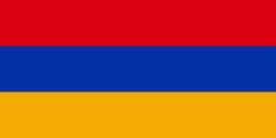
| Flag of Armenia | |
Armenia is a unitary, multi-party, democratic nation-state with an ancient cultural heritage. The first Armenian state of Urartu was established in 860 BC, and by the 6th century BC it was replaced by the Satrapy of Armenia. The Kingdom of Armenia reached its height under Tigranes the Great in the 1st century BC and in the year 301 became the first state in the world to adopt Christianity as its official religion. The ancient Armenian kingdom was split between the Byzantine and Sasanian Empires around the early 5th century. Under the Bagratuni dynasty, the Bagratid Kingdom of Armenia was restored in the 9th century. Declining due to the wars against the Byzantines, the kingdom fell in 1045 and Armenia was soon after invaded by the Seljuk Turks. An Armenian principality and later a kingdom Cilician Armenia was located on the coast of the Mediterranean Sea between the 11th and 14th centuries.
Currency / Language
| ISO | Currency | Symbol | Significant figures |
|---|---|---|---|
| AMD | Armenian dram | Ö | 2 |
| ISO | Language |
|---|---|
| HY | Armenian language |


